
We Listen First…
We represent the interests of our clients and work with you to determine the right data (type, accuracy, formatting, etc…) to support your project then identify the best technological solution. Your specification is distributed to our pre-qualified network (over 100 providers world-wide) possessing that technology/service who aggressively compete for the work. Our technical experts (CP’s, PMP’s, etc.) provide continual oversight and perform a independent QA/QC to ensure specification compliance prior to delivery to you. Quality – the right specification, data and right technology has resulted in 100% of our projects (since inception in 2009) being completed successfully and at a savings to our clients in both time and money – fact!

Quickest Data Delivery
We recognize your time is valuable and your work cannot start until our data is delivered. It is proven that the right data (no more / no less) generated with the right technology and experience combined with sensor centric data processing workflows results in the quickest turn-around time possible. Our extensive data acquisition network strategically located throughout the US and International offers local knowledge and the shortest equipment mobilization time & cost. Unlimited resources and in place contingency plans allow us to meet the most demanding schedules anywhere in the world.

We Deliver the Most Cost-Effective Solutions
Cost is of minimal concern when the wrong, delayed or inaccurate data is delivered. Add the time you spend trying to mitigate the situation. The key to success is communication and experienced oversight as technology rarely fails when correctly applied. A precise specification yielding the correct data applying the most effective technology will always produce the lowest cost – always! Our primary focus is delivering excellent value for professional services to all our clients.
As a service oriented organization, we are building the company one partner at a time. We articulate the requirements, produce the data and manage the entire process with your interests in mind, and then finish with an independent QA/QC to ensure compliance prior to delivery. Challenge us against your current process or provider and allow us the opportunity to prove the difference.
Keep focused on your business while we take care of your remote sensing needs. SUBMIT A PROJECT
CEO Corner
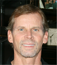
Larry Schaner Founder & Acting General Manager
Spatial Intel and CloudMAP Services were established to assist the needs of the end user of Remotely Sensed data and services by providing unprecedented experience and turn-key solutions within the disciplines of Aerial Photogrammetry, Remote Sensing (LiDAR & Imagery) and GIS… Read More